The valleys of Bergamo by bicycle: from Lake Iseo through the Prealps
From Riva di Solto to Camonica Valley
 We follow the same track of the itinerary around Lake Iseo till we meet the dirt banks of Oglio river. Instead of continuing towards Pisogne you stay on the track that runs along the water edge among funny, rocky passages. In a few hundred meters you crop up on the real cycleway of Camonica Valley. Following the signals (present and accurate) of the cycle itinerary you reach the bridge for cyclists and pedestrians of the river Oglio which is necessary to cross before resuming our trip in the province of Brescia.
  The cycle way of Camonica Valley is almost entirely in the territory of Brescia and connects Ponte di Legno and Pisogne notwithstanding a link road till Costa Volpino has been set up too. Following the cycle way reach soon Darfo Boario Terme, the last town of the valley before entering Via Mala.
Via Mala


Presolana Pass and Seriana Valley
 You feel the fatigue and each pedal is more and more difficult. The last hairpin bends of the Presolana Pass make breath again with beautiful landscapes of Scalve Valley. 1297 m and we are on top: the Presolana Pass is the access gate to Seriana Valley and is shared by three different municipalities, one of which is Angolo Terme, in the province of Brescia.

Riso valley and Colle di Zambla
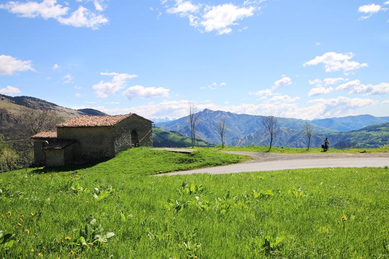
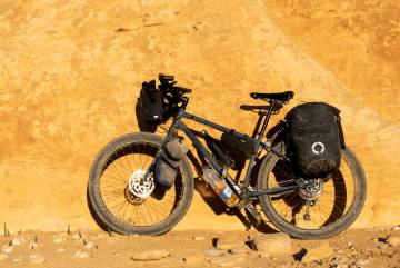
 To continue to Colle di Zambla it is necessary to leave the cycle path one kilometer earlier to go back to the SP46 road. The main road climbs with difficulty among small mountain villages, long hairpin turns and landscapes increasingly beautiful. The bags are heavy and the tops enclosing Valle del Riso are worth a few photographic stops. Colle di Zambla almost touches 1240 meters and it is the pass connecting Val del Riso and Serina valley, preview of Brembana Valley.


Valcavallina and Iseo lake
 The final rise ends in Solto Collina from where you enjoy a beautiful view on the lake before going down to Riva di Solto, our starting point and arrival of the 3-day itinerary suitable for cycling among the valleys of Bergamo.
- Lake Iseo with its alpine landscapes and the highest island of all European lakes. You can follow the whole lake by bicycle.
- The Via Mala, this ancient medieval road between Val di Scalve and Valle Camonica
- Clusone with its astronomical clock and the Oratory of the disciplines with the terrific Danza Macabra
- San Pellegrino Terme with water known throughout the world and the controversial Art Nouveau Casino
- The splendid Upper Bergamo with the Venetian walls became part of the UNESCO World Heritage Sites
- I do not recommend the journey in winter due to the ice along the Via Mala and the possibility of snow at high altitude
- The best seasons to tackle the cycle route are late spring and early autumn, perhaps avoiding weekends (many motorbikes on the way!)
- Part of the track takes place on cycle paths (two old railways converted into cycling routes!), while the rest follows secondary roads
- The route of the Via Mala is mostly on dirt and single trail invaded by weeds. If you want to follow the main road instead of the dirt road I suggest you follow the route in the opposite direction so you will pedal downhill (there are galleries!)
- The lakes of Iseo and Endine are both suitable for swimming. If it's hot, take advantage of it!
We spent the night in Clusone staying at the Bonaventura guest house for € 40 in two (it is near a pizzeria, about 1 km from the center), but there are also other alternatives such as apartments on airbnb discounted if you are not registered yet or the camping. In Bergamo and in the Brembana Valley (San Giovanni Bianco and San Pellegrino in particular) there are other alternatives to stay at a good price (especially in low season!)
- At Lake Iseo, try the baked tench, a fish from the lake, dressed with olive oil from the area
- In the entire province of Bergamo do not miss the Casonsei;
- In Val Seriana taste the Tosei from Rovetta
- Try the Spongada, a typical dessert in ValCamonica
- In the valleys, taste the numerous malga cheeses and not, accompanied by yellow polenta. The best known is the Branzi of the Brembana Valley
- InLombardia : the tourism portal for the Lombardy region
- Visit Bergamo : the official tourism website in the city of Bergamo
- Visit Lake Iseo : the dedicated site to tourism on Lake Iseo
- Val Seriana : the site dedicated to tourism in the Valley Seriana
- A good map that covered the area is Alpi Orobie bergamasche by Kompass
Log in with ( Sign Up ? )
or post as a guest
Be the first to comment.

Vero
ITA - Correva l'anno 1983 quando ha sorriso per la prima volta alla luce del sole estivo. Da sempre col pallino per l'avventura, ha avuto la fortuna di girare l'Europa e l'Italia con i genitori e poi, per la maturità, si è regalata un viaggio in 2 cavalli da Milano verso la Russia. Al momento giusto ha mollato il lavoro senza alcun rimpianto per volare in Nuova Zelanda dove ha viaggiato per cinque mesi in solitaria. Nel 2007 ha provato per la prima volta l'esperienza di un viaggio in bici e, da quel momento, non ne ha potuto più fare a meno... così, dopo alcune brevi esperienze in Europa, nel 2010 è partita con Leo per un lungo viaggio in bicicletta nel Sud Est asiatico, la prima vera grande avventura insieme! All'Asia sono seguite le Ande, il Marocco, il Sudafrica-Lesotho e #noplansjourney. Se non è in viaggio, vive sul lago d'Iseo! Carpediem e buone pedalate!
EN - It was 1983 when he smiled for the first time in the summer sunlight. Always with a passion for adventure, she had the good fortune to travel around Europe and Italy with her parents and then, for maturity, she took a trip in 2 horses from Milan to Russia. At the right moment he quit his job with no regrets to fly to New Zealand where he traveled for five months alone. In 2007 she tried the experience of a bike trip for the first time and, from that moment on, she couldn't do without it ... so, after some short experiences in Europe, in 2010 she left with Leo for a long cycling trip in South East Asia, the first real great adventure together! Asia was followed by the Andes, Morocco, South Africa-Lesotho and #noplansjourney. If he's not traveling, he lives on Lake Iseo! Carpediem and have good rides!


