Cycling Venosta Valley: the cycle path from Resia Pass to Merano in South Tyrol
Technical data
Cycling Venosta Valley Cycle Path - South Tyrol
| Start / Finish | Passo Resia / Merano |
| Time | 5-8 hours |
| Elevation gain |
150 m circa
|
| Length | 80 km |
| Type of terrain |
Gravel 8 %
Asphalt 92 %
|
| Suggested bike |
Trekking Bike
Touring bike
Mountain Bike
|
| Difficulty |  |
| Views |  |


From Resia Pass to Malles
The Venosta Valley Cycle Path starts at Resia Pass, connecting Austria to South Tyrol and hosting the Adige river's first steps. Actually, the locality of Resia, a couple of kilometers before the border, north of the namesake lake, is the perfect starting point and the best part of the itinerary. The cycling track allows us to pass the border and enter Austria reaching safely Landeck.


An alternative itinerary... downhill!


From Glorenza to Prato, at the foot of Stelvio
 The Venosta Valley Cycle Path continues towards Sluderno and Prato leaving behind the beautiful Glorenza. Passing by an artificial lake while the look wanders into villages on the mountains and old manners guarding the passage towards Austria. Coira Castle is one of them: well preserved despite it dates back to the Middle Ages, it's located in Sluderno and you can visit it by reaching the deviation along the path towards the village.

Lasa and the marble
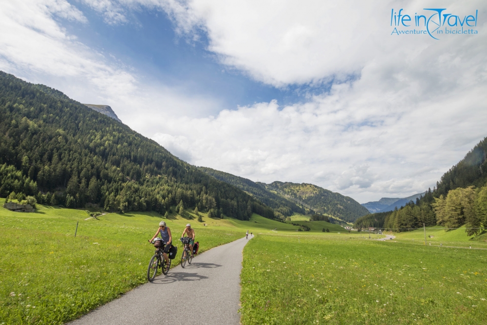
 You will ride on the side of infinite apple trees on both sides of the Venosta Valley Cycleway. Just after the fork towards Vezzano, a farmer had the brilliant idea to build a self-service table, where you can try apple juice and other local products from the valley... don't forget to always leave a correct sum! What really gets us is the variety of panoramas here, the number of bicycle tourists, children and grandparents included, the changes in the terrain and the beauty of the path, leaving many feelings in our hearts.
And suddenly... Castelbello

The last hairpin turns towards Merano

- Resia Pass with its lakes and the bell tower of the old Curon Venosta
- Glorenza, one of Italy's most beautiful villages
- A short detour in Val Monastero until the border with Switzerland
- An iced Forst in Foresta at the brewery
- A detour to visit Castel Coira and the other castles in the valley
- The elegant Merano and its Austrian soul
- How can I reach the starting point, Resia Pass? You can reach Resia by private transfer from Malles, the last train station in Val Venosta. Otherwise you can ride! Malles train station is easily reachable by train from Bolzano.
- When is the best time of the year to ride on the Val Venosta cycle way? The best time of the year to visit the area is spring, maybe summer (but avoiding the period July 15th - August 15th) and autumn, when the woods are painted in the lower part of the valley and apples are picked.
- On the itinerary you can find many signposts, so getting lost is very difficult.
- On the itinerary you will find many water sources.
- Connected itineraries: from Malles Venosta you can enter Val Monastero towards Switzerland and Umbrail Pass, from Lake Resia you can get to Austria and, once passed the border, take the Inn River Cycle Path, from Prato allo Stelvio you can climb the namesake pass and reach Bormio in Valtellina, and the Sentiero Valtellina, from Merano you can cycle to Bolzano on the Adige Cycleway or towards Caldaro Lake on the old railway Oltradige.
- Val Venosta cycle path can be covered in one day, but you can choose to enjoy the stunning landscapes of the mountains or take a detour in one of the secondary valleys. You can sleep in San Valentino alla Muta, in Glorenza or in Merano. If you want a whole apartment, take a look at AirBnB.
- What can I eat in Val Venosta? In Val Venosta absolutely try Pagnotta venostana accompanied by a local cheese or some speck. Among Alto Adige food, you can try canederli, spätzle and goulash (recipe from the Austro-Hungarian Empire).
- Where can I eat in Val Venosta? As a great stop I suggest Glorenza, to visit the village! You can stop at Flurin - Bar, Restaurant & Suites, where you can also sleep. In Foresta don't miss the Braugarten Giardino Forst.
- Suedtirol.info: the South Tyrol official web portal
- Venosta.net: Val Venosta web portal
Log in with ( Sign Up ? )
or post as a guest
Be the first to comment.

Francesco G
ITA - Ho 33 anni e sono piemontese, anche se da qualche anno vivo e lavoro in Lombardia. Dopo un inizio da totale inesperto in questo campo, mi sono avvicinato al mondo dei cicloviaggi e della bicicletta sempre più. Oggi posso definirmi "cicloviaggiatore", e assieme all'altra mia passione - il videomaking - non mi fermerei mai! Cyclo ergo sum, pedalo quindi sono, per cercare di capire perché andare in bici sia così bello, terapeutico, ricco... E ogni volta che provo a capirlo, non ce la faccio, e sono costretto a ripartire sui pedali!
ENG - I'm from Piedmont and I'm 33 years old, I have been living and working in Lombardy for a few years. After a start without any competence in this field, I then approached the bicycle world more and more. Today I can call myself a bicycle traveller and videomaker who would never ever stop. Cyclo ergo sum, I cycle therefore I am. I ride my bike trying to understand why it is so beautiful, rich, therapeutic. And every time I try, I do not understand it. So I must leave again...
Latest from Francesco G
- Farewell Iohan Gueorguiev, you will always inspire us!
- The Oglio Greenway: cycling adventure from Tonale to Po
- Naturehike Cloud Up 2: my review of this bikepacking tent
- Bikepacking or Bike Touring? This is the question
- Best gravel handlebars and how to choose them
- Roswheel bags: Roswheel Tour Pannier Large review


